Ottawa under severe weather threat for second day in a row
Posted May 22, 2024 11:25:25 AM.
Last Updated May 22, 2024 04:55:15 PM.
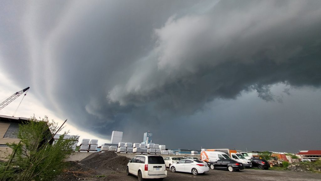
The nation’s capital was put under under a severe thunderstorm watch by Environment Canada on Wednesday afternoon.
Ottawa, along with most of southern Ontario, is bracing as storms roll through this afternoon and evening.
According to the weather agency, conditions are “favourable” for severe storms, large hail, heavy rain and strong wind gusts.
“Lightning kills and injures Canadians every year. Remember, when thunder roars, go indoors,” the website reads.
The watch covers parts of the Ottawa Valley, Chelsea, Que. and stretches north toward Algonquin Park and as far south as Brockville, Ont.
Storms developed due to a cold front moving through the province, wind gusts could reach 90 km/h and hail could be as large as a Toonie.
“Heavy downpours can cause flash floods and water pooling on roads,” Environment Canada says. “Water-related activities may be unsafe due to violent and sudden gusts of wind over bodies of water.”
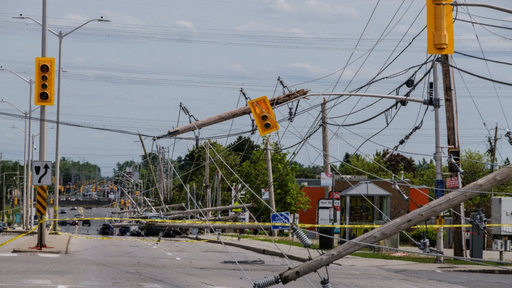
This storm watch comes after Ottawa skies darkened yesterday afternoon after Environment Canada issued a thunderstorm warning.
The warning was first issued shortly after 4:30 p.m. threatening of a storm producing strong wind gusts and heavy rain. The warning was in place for around two hours before being dropped.
These storms came two years after the Ottawa area experienced a fatal derecho.