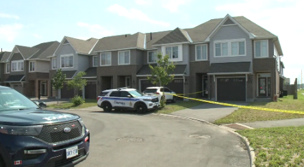
Ottawa’s storm dubbed a ‘derecho’ by Environment Canada
Posted May 22, 2022 06:28:00 PM.
What Ottawa experienced Saturday night was not a tornado, nor was it a microburst. The proper term, David Phillips, senior climatologist says, is called a “derecho.”
A derecho, Phillips explained to CityNews Ottawa on Sunday, May 22, is a series, or a family, of thunderstorms that move along an area at fast speeds – speeds, he says, that are as fierce as a fast-moving car.
“It has winds that can be as powerful as a hurricane. You can have tornadoes embedded in derecho or group of thunderstorms – some people call it a squall line or an unsalted area. It’s the same result,” he explained.”
Essentially, they are a widespread, long-lived wind storm that is associated with a band of rapidly moving showers or thunderstorms.
The storm, Phillips says, stretched from the 401 in Windsor, then made its way through eastern Ontario and Quebec.
These events, he adds, aren’t that common.
Phillips also believes damage could have been a lot worse, as well as injuries, if Ottawa residents hadn’t received an emergency warning on their phones.
“We’re seeing a lot more destruction by weather but really, in spite of what we saw yesterday, there are fewer people dying from the weather and it’s maybe even more tumultuous than it used to be. But because of warning, because of the system and because Canadians are well educated about the weather, we don’t take it lightly. We respect weather. We do the right thing. We know where to know when violent weather breaks out.”