Extreme weather in Ottawa with flash flooding, severe thunderstorm possible
Posted Jul 24, 2024 11:17:11 AM.
Last Updated Jul 24, 2024 05:12:57 PM.
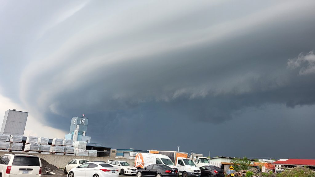
Environment Canada issued a warning on Wednesday afternoon due to “favourable” conditions for the development of severe thunderstorms and even tornadoes.
The area could see strong wind gusts, large hail and heavy rain. Wind could be as strong as 110 km/h and nickel to golf ball-sized hail is possible.
“Heavy downpours can cause flash floods and water pooling on roads,” the warning reads. “Strong wind gusts can toss loose objects, damage weak buildings, break branches off trees and overturn large vehicles.
A tornado warning was issued for Prescott and Russell around 1:45 p.m. but there has been no confirmation of a tornado touching down.
“The main threats will be strong winds, torrential downpours and hail,” the watch says. “There is also a risk of a tornado today, especially towards the Ottawa River Valley.”
Torrential downpours with 50 mm falling within an hour could happen.
The storm system, which has forced weather alerts across the southern half of the province, is predicted to be in Ottawa throughout Wednesday.
“Severe thunderstorm watches are issued when atmospheric conditions are favourable for the development of thunderstorms that could produce one or more of the following: large hail, damaging winds, torrential rainfall,” Environment Canada says.
Keep it here for your latest weather details.