Snow and wintry blast expected in Ottawa this week

Posted Nov 24, 2025 12:51:04 PM.
Last Updated Nov 25, 2025 09:36:17 AM.
Meteorologists and weather experts are eyeing the end of the week across Ontario, expecting another blast of winter.
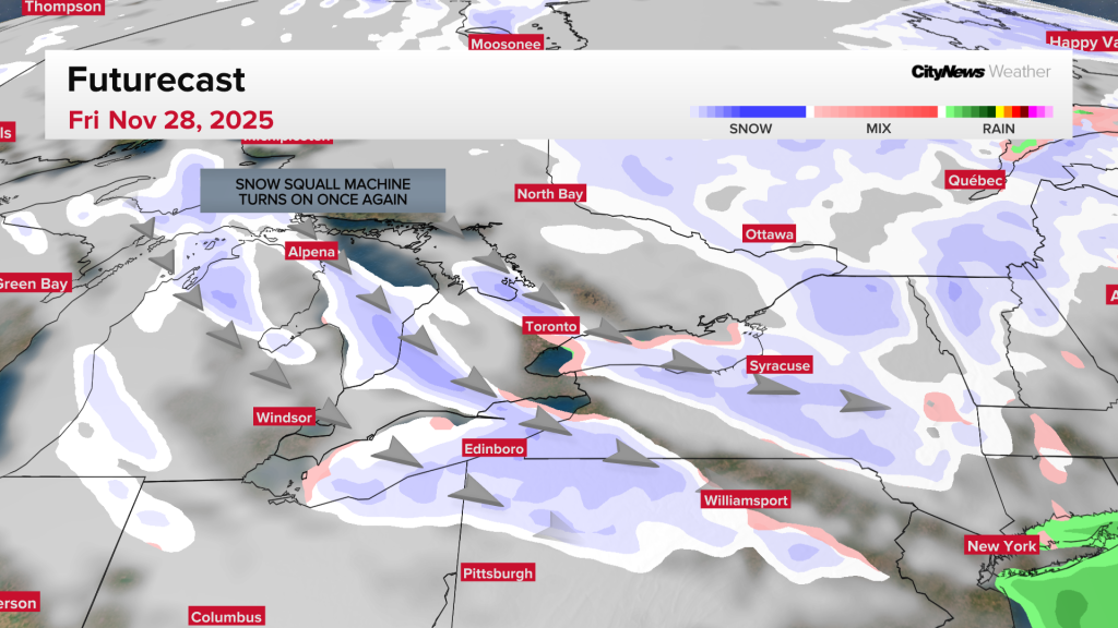
Parts of northern Ontario are bracing for snow this week, with forecasters warning of significant snowfall and lake‑effect squalls set to hammer southern regions as November draws to a close.
A developing low‑pressure system south of Lake Superior late Tuesday is expected to trigger widespread snow through Thursday, creating hazardous travel conditions across northern Ontario. Environment Canada has issued winter storm watches for dozens of communities in the northern parts of the province, including Thunder Bay, Timmins, Kapuskasing, Marathon, and Wawa.
“Strong northerly winds will also accompany the snow, leading to possible blowing snow that could reduce visibility to near zero at times,” writes Environment Canada on Monday. “There remains uncertainty with the exact track of the low-pressure system, and therefore the corridor of heaviest snowfall. Total snowfall amounts may exceed 30 cm for some locations north of Lake Superior.”
Winter weather depends on a weak or disrupted polar vortex, Natasha Ramsahai, CityNews meteorlogist, said. In this case, the disruption will mainly be due to something called an “SSW” or “sudden stratospheric warming,” which will weaken the “wind wall.” While spills of cold air at this time of year are not unusual, the “SSW” event that will cause them is early for this time of year, happening only a couple of times this early in the season in the past 70 years, she said.
The current La Niña is also playing a role in this shift to cold weather. The CityNews winter outlook released earlier this month maintains that the first half of winter will be cold across the Great Lakes, while the second half in early 2026 looks to be milder.
Drivers are being urged to prepare for poor visibility, slick roads and possible closures.
The forecast for the nation’s capital is calling for snow, but predictability is low this far out.
Environment Canada shows a high of 2 C and temperatures hovering around 0 C on Friday. Overnight temperatures will be cooler around -10 C.