Ottawa prepares for 40 cm more of snow
Posted Feb 15, 2025 08:54:46 AM.
Last Updated Feb 15, 2025 08:56:58 AM.
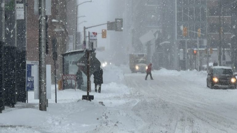
As the City of Ottawa continues to dig its way out of the depths of the snow that fell last week, another winter storm system makes its way across southern Ontario. Now Ottawans are preparing for the possibility of 40 more centimetres of snow.
Early Saturday morning, Environment Canada issued a winter storm warning for the region, beginning Saturday afternoon and lasting into Sunday evening.
“A potent low pressure system will bring another impactful winter storm to the area,” a statement from Environment Canada reads. “Conditions will rapidly deteriorate Sunday morning as a more significant area of snow and blowing snow arrives.”
Peak snowfall rates could reach three to six centimetres of accumulation per hour, making travel dangerous.
“Visibility will be suddenly reduced to near zero at times in heavy snow and blowing snow,” the statement says.
OPP are cautioning residents to stay off the roads more all non-essential travel. OPP responded to nearly 40 crashes in the eastern region in a eight hour period between Wednesday night and Thursday morning.
“If you do have to be on the roads, adjust your driving,” the force wrote on X. “Slow down, leave extra distance and ensure you clear snow from your entire vehicle. Make sure to check your tail and brake lights whenever you stop, as they tend to get covered as you drive.”
The City of Ottawa is also asking residents to look out for those in their communities. This includes keeping fire hydrants clear of snow to ensure firefighters have access if needed. There have been a high amount of calls for fire services over the past week.
A significant weather event remains in effect throughout the city. No parking bans have been put into effect yet.